
Sunbrige
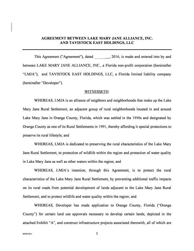
LMJ Alliance Signed Finalized Legal Agreement with Tavistock and Deseret
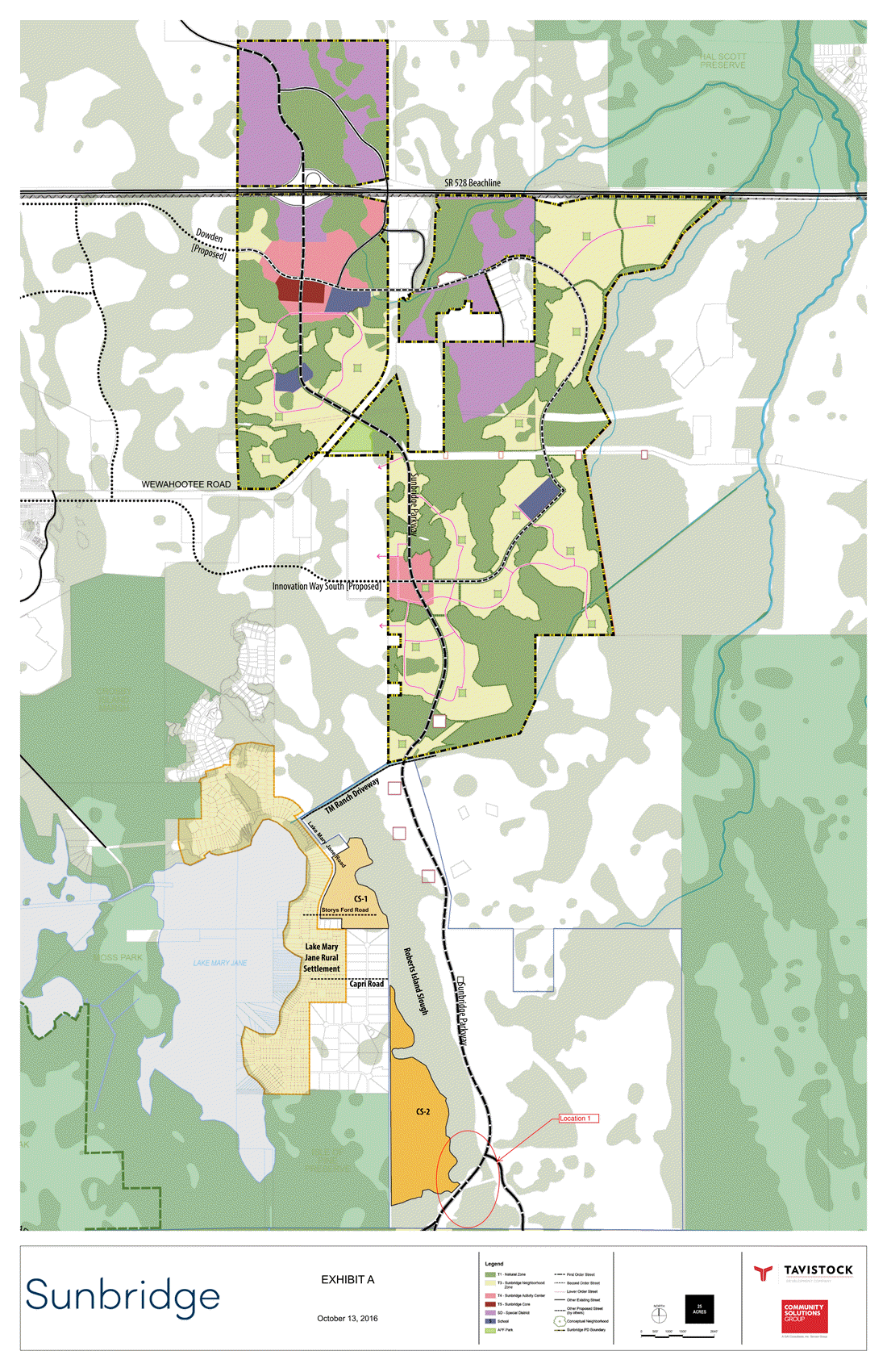
On November 23, 2016 your LMJA President and LMJA Communications Chairperson signed this legal agreement. This document will protect our Rural Settlement from any traffic (including construction) from the Sunbridge Parkway or if there is future development behind the five acre lots (CS-2 on map.) This will also require OFW (Outstanding Florida Water) standards for all of the discharged water from Sunbridge. This will allow any development for CS-1 parcel (which is right on LMJ Rd between TM Ranch Driveway to the start of IOP) to use LMJ Rd (as they currently have the right to do this now) but not to connect to the rest of Sunbridge. Please see the Exhibit A map for locations of CS-1 & CS-2.
Detailed plans for the wildlife corridor are not included at this stage, but the agreement acknowledges that the LMJ Alliance will be working with Tavistock going forward to ensure appropriate standards are met. Your LMJ Alliance Board has been working on this agreement for 4 months to make sure our community, the natural resources, and the wildlife that surrounds it are protected as much as possible from potential impacts.
We commend Tavistock for patiently working with us to come up with solutions that are a win/win for all involved. We thank the residents of our Rural Settlement for their support of this unprecedented type of agreement with a developer.
We would also like to thank our attorney Mr. Flowers from Lewis, Longman, Walker PA for his expert advice in guiding us through this process and for carefully looking out to help protect our community.
We hope that with the agreement in place, the LMJ Residents will now join our LMJA Board in our support of Tavistock‘s Sunbridge plans. Tavistock will go before the BCC for their next step in the process on Tuesday Nov. 29th. In the past we have been either opposed, or as the legal agreement process started we were neutral. With this document completed and signed and submitted to Orange County, the LMJ Alliance will be in support of Sunbridge.
We want our residents to understand this legal agreement. If you have questions on this document, please email our LMJA Communication Chairperson SuzArnold@mindspring.com.
 Text document is final LMJA/Tavistock agreement.
Sunbridge Oct 18th Board of County Commissioners (BCC) meeting rescheduled to November 29th.
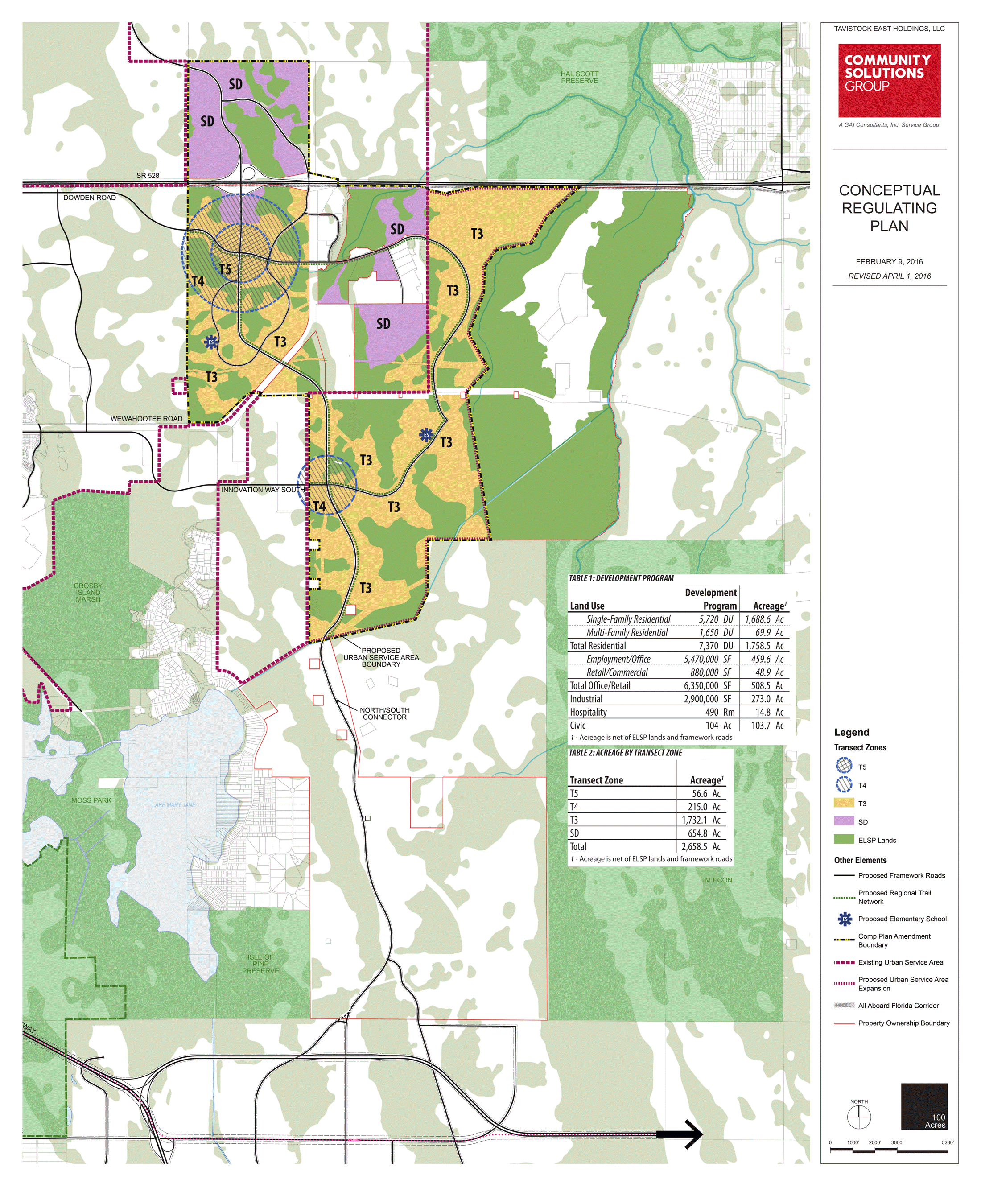
Click the PDF icon for the Planned Development Regulating Plan.
![]()
Click the PDF icon for the Tavistock Response to Comments document.
![]()
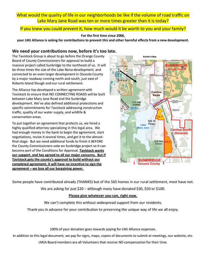
The developer (Tavistock) and the property owner (Deseret) have agreed to keep all Sunbridge traffic for the current proposal out of the LMJ Rural Settlement (including permanent, temporary and construction traffic.) But what about the NEXT section of Sunbridge?A long two lane paved road with a recreational trail will connect Sunbridge Orange County to Sunbridge Osceola County througha massive undeveloped property which is also owned by Deseret and is right next the LMJ Rural Settlement. This property includes land on LMJ Rd from the TM Ranch to the Isle of Pines, and also behind the 5 acre lots.If Sunbridge is successful and there is already a road in place, why wouldn’t they develop this parcel next?
We are taking a 3 step approach to protect our community, the environment/water/wildlife
- To protect our rural settlement from traffic on our roads (already agreed to)
- Protect our rural settlement from future high densities adjacent to our rural settlement including land on LMJ Rd from TM Ranch to the Isle of Pines and also behind the 5 acre lots in Lake & Pine Estates (working on a legal document)
- To get better protection for the wildlife corridors and get stricter stormwater runoff standards than required by ELSP etc. (still working with multiple environmental agencies and specialists to request best solutions)
The document above is the basis for the legal document. The LMJ Alliance is working with both the developer and the land owner to come to an agreement on the future land use of parcels up against the rural settlement. We are working with an attorney to turn this into a legal binding document.
Sunbridge Map including Osceola County
Sunbridge plans include

- International Corporate Park (already approved but current plans change part of the layout)
- A portion of what was originally Magnolia Ranch, then Innovation Way East (IWE), but this time the plans do NOT include land east of Turkey Creek)
- A 19,000+ acre parcel in Osceola County
- A 2 lane paved road with a 12 ft wide recreational trail that will connect the 4700+ acres in Orange County to the Osceola parce. The road has been placed on the far side of the Roberts Island slough - not next to the rural settlement.
Detailed map of Orange County Sunbridge plans that shows the LMJ Rural Settlement
- Tavistock will be the developer.
- Sunbridge is 4787 acres in Orange County with 1,692 acres of preserved land (including existing wetlands)
- 5720 homes plus 1650 multi-family units (apartments, condos, townhomes etc)
- 9 million sq ft of commercial space (office, industrial and retail.)
- 490 hotel rooms
- If approved, construction will begin in 2018
Great Community Meeting on April 27th with over 120 Residents Attending!
Residents filled out petitions and surveys and reviewed detailed maps.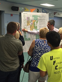 |
 |
 |